 Message Me
 1948 Vintage, Ordnance Survey, National Grid One-Inch Map, London S.W, Sheet 170 in Plymouth


1948 Vintage, Ordnance Survey, National Grid One-Inch Map, London S.W, Sheet 170 in Plymouth
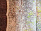
You are looking at a Ordnance Survey, National Grid map covering "London S.W. from 1948. Was found during a turn out and now needs a new home.
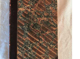
Overall in good condition considering the age. It does have a few tears and the corners at the bottom on the front seem to gave been cut or ripped off at some point. Otherwise, condition as per the pictures.
Item Details:-
Item: Fold Out Map
Make:- National Grid - Ordnance Survey
No: Sheet 170
Year:- 1948
Area: London S.W.
Scale: One-Inch
Folded Size (Approx): Width: 12.5cm, Length: 21cm, Thickness: 1cm
Condition: Very good for the age though does have a tear on the front and back ripped corners at the bottom (please see the pictures)
Printed on the Front of the Map:-
"National Grid
170
Ordnance Survey
New Popular Edition
One-Inch Map of England & Wales
London S.W.
Sheet 170
First Published 1945
Full Revision 1930 Roads 1948 with later corrections
Price (Cloth) Five Shillings Net
The listed postage price of £2.75 is for Royal Mail Second Class. Free collection is also welcome from the Hooe area of Plymouth.
Please get in touch if you have any questions.
Read more
- Phone verified
Similar Ads
-
 Interesting historical coins£10
 -
John James of Redditch Vintage Sewing Kit.£40
-
Walking sticks for sale£8
-
Old train tickets£9
-
Findsoftheworld is on Etsy selling bundles of...£4
-
Collection of postage stamps.£30
-
Vintage/Collectible, Vesttinn Pewter Bowl ...£25
-
Collectible, Zak! Designs, Metal, Star Wars...£12
-
Antique Book, 1920, Gems from Longfellow - Rare...£45
-
1980, Vintage, Soviet/Bulgarian, Decorative...£35
-
Antique Barbour Bros Co Quadruple Silver Plated...£27
-
Vintage, Austrian, Stoneware, Steins, Original...£24
-
Signed Photo, 6"x8", 5 Signatures, R Crowe, H...£350
-
Vintage, "The Salvation Army", Silver Plated...£10
-
FRIENDS, Photo with 5 x Genuine/Real Cast...£320


Buyer's Advice

Get alerts on new ads & updates